Tuesday, December 11, 2012

New Hampshire and California

The long brick Salmon Falls Mills, in Rollinsford, NH, perch on the west bank of the Salmon Falls River.  Rollinsford is my choice for the final town in my two year project, DRAW-NH.  Yes, town #234.

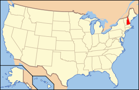
New Hampshire once flourished with mills based on water power.  The topography of the state produces streams and rivers with fast moving currents. 

Most of New Hampshire’s mills are no longer functioning as mills. The still solid, brick and granite buildings, are repurposed with new uses. Small industries, offices, housing, and colleges occupy the high ceilinged rooms.  Here at the Salmon Falls Mills, at the border with the state of  Maine, over 80 artists create in the well lit studios. The town library has found a wonderful home here too.

Two granite benches along the river caught my attention. My hot spicy chai tea, set down nearby, I began to sketch in charcoal.  The clear cool day produced sharp shadows. Then out came the watercolor set, then my favorite colored pencils as a last step.

To the far right, you see the river, the falls over the rocks, a bridge over the river, and a passing train on the top level.

After pausing to study my composition on paper,  I noticed  the grassy foreground without much detail.  So I looked more closely at the hill.  And what did I see?  My shadow, complete with my sketchbook, and my left hand holding the pencil. Perfect, my shadow on the grass became part of the drawing.


Rindge, NH was the 200th town in my DRAW-NH project. After roaming around quite a bit, I stood on the sidewalk in front of the library for this composite view.

In fact, I had walked all the way up the hill to the bandstand on the far left. So when designing  my composition, the bandstand was included it even though it is really behind some trees.  I enjoy making compositions which are almost like maps.  They clarify the spacial positions of things of interest.

The large white wooden clad building in the center is the town hall. It was built as a meeting house in 1796, and acquired by the town in 1839. The town rents out the second floor to a local religious group. Or first floor, depending how you count them.

The sign is in front of the town library.  You can see the walkway leading to the right.  It was summer time and the library shows movies for the children on school vacation.

The odd and unusual tower to the right tower is part of a private residence.


The name of my blog being Colorful Journey, my driver knows well to slam on the brakes when such a scene appears.  This is Lee, NH, very close to Durham where I attended the University of NH.  But I didn’t have a car, and I didn’t leave campus much. Except to go to France for one year.

The house really is orange sherbet color.  Or sorbet, to be French. This boxy style of architecture dates from approximately mid 1770s to early 1800s. The red box is a barn. Red was an inexpensive color, made from iron oxide. Many houses were originally left unpainted, whitewashed, or slapped up with whatever was available.  The more money an owner had, the more pigment he could buy, and the brighter the house might be.  The tradition of white painted houses only dates from the 1930s according to my historical advisor.

This was done during November, a transitional season here.  One tree still has its yellow leaves (they will soon float to earth); the purplish tree is a bare deciduous tree.  The shadows are long, but the grass is still quite green.  No snow has fallen yet. The dark green trees are evergreens and will retain their fragrant needles all winter.

The main road turns sharply to the right. Two yellow directional arrows assist the driver.


It took a lot of walking around here in Strafford, NH, looking for just the right angle.

Curves in roads appeal to me, and here we have a double curve. Or a parallel single curve. And two bell towers, one on a church and one not.  Bell towers were necessary to strike the hour, or to call villagers to services or school classes.  They were also used to indicate an emergency such as a fire.

Building styles will shift subtly from one part of the state to another. Here we have a tiered stack of building blocks, piled up like children’s toys.  The tops are both domed, and with weather vanes.

The building on the left with the old plow on the lawn is Austin Hall, the home of the Strafford Historical Society Museum and formerly of the Austin Academy, a secondary school.  We would now call this a high school.  Students boarded in the town if they lived far away. It is no longer a school but has recently been restored as a community meeting space.  The windows and doors are decorative and unusual.

The white wooden building on the right is the 3rd Baptist Church.  I find it interesting that the architecture is so similar between a church and a school that was never associated with a religious group.

The building in the middle is a home, and exhibits the ‘connected’ building style of central New England architecture. A small out building was often moved rather than building a new one.  Very large buildings were moved too, usually in winter, on skids or rollers on packed snow roads, pulled by oxen.


 The white wooden-clapboarded First (and only) Baptist Church  in New London, NH. sits on a corner on Main Street.  We are looking at it through the beautiful window of the Whipple Town Hall.  In the tower is a Revere Bell. 

Boston, Massachusetts resident Paul Revere, 1734-1818, was an extremely talented silversmith.  Examples of his candlesticks, teapots, buckles, and other domestic wares are on display at the Boston Museum of Fine Arts. Besides iron casting and copper sheet rolling, he is best remembered for his bronze bell factory.  Between 1792 and 1828, his foundry cast 398 bells of all sizes.

Henry Wadsworth Longfellow immortalized Revere in his poem “The Midnight Ride Of Paul Revere”. This poem refers to Revere’s activism as an American patriot in the years leading up to the American revolution.


I love to fly across the North American continent on a clear day heading into the sun set.  The planes’s wing is on the upper right.  I am magically drawing the sunset through it.

This mountain caught my eye, and my pencil because it looked volcanic in shape. In the very middle is a narrow and deep canyon.   And in the lower left I drew another canyon which showed colored layered rocks, appearing sort of red and white.

I am not sure what state this is.  Maybe California, or Utah.  We were flying from Chicago to LA. I guess it doesn’t matter what state it is since we are seeing nature without map boundaries. It is all planet Earth.


This is the view out the door of our motel room in Anaheim, California. We were there, nine people, for seven days, four theme parks, three grandchildren, two sets of grandparents, and a partridge in a pear tree. Just kidding on that bit.

As a northerner, it is hard for me to see the point of palm trees.  Good for dates and coconuts I’ve heard. But shade, no.  The tops look like sky scribbles. The tree trunks resemble legs of a giant creature.  But when I see palm trees, I know I am on vacation.

My very first palm tree sighting was at age twenty, in Menton, France. Off the train I stepped, from gloomy grey (but nice)  Dijon where I lived, into azure skies, with palms, and lemons growing right on the trees. Stunned, I plopped onto a park bench. The sun was warm, and the scent citrusy. The wonder of it all.

The Côte d’Azur (or the French Riviera as we say in English) was the first place I ever saw where the mountains met the sea.


In July we drove to Colebrook near the top of the state of NH, to stay over two nights.  Near Colebrook is the tiny town of Columbia. I drew the conical fir trees marching over the steep hills like rows of toy soldiers. Each one is destined to become a family’s Christmas tree.  Eight  to ten years pass from seedling to full cutting size.  And today’s customers demand a perfect shape, which means annual pruning.

I miss the old kind of trees, which were always more sparely branched on one side.  That is the side that goes against the wall. The tree would get twirled around, and the family members would chime in as to the ‘best side’ of the tree. And I miss having space between the horizontal branches, where you can see right through the tree and hang the heaviest ornaments. And the lead (!) icicles hung nicely.

And sometimes we kids would find a bird’s nest in the tree.  Usually the tree had a crooked top.  Now that is nature.


Burdick’s, a restaurant, cafe, and chocolatierie  in Walpole, NH,  has the BEST hot chocolate.  I can taste the chocolate all the way home, an hour and a quarter to my house. They have outlets in Boston and New York City too, but I go to the one in New Hampshire.  In the fancy, tiny gold foil box is one  scrumptious truffle to savor later.


Last year, we went to see and hear Tuba Christmas at the New London, NH town hall.  Armed with a pad of paper, as well as soft charcoal sticks and colored pencils, I sat way in the back on a stack of about four chairs. Joyful would describe the experience of drawing and listening to beautiful music.

Tuba Christmas concerts were started in New York City in 1974, and have since spread world wide. As the name implies, only brass wind instruments are supposed to be on stage. There is one semi-hidden, non-brass instrument hiding in the back row—a double bass, which the musician and the conductor refer to as a ‘wooden tuba’!

Heavy wool sweaters, and Santa hats are the dress of the day. And plaid flannel shirts.

Happy Holidays to all, and a wish for peace in the New Year.


Friday, November 2, 2012

New Hampshire


A trip down New Hampshire’s Atlantic seacoast 


New Castle, NH is a town located on a large island and a number of much smaller ones, lining the entrance to the harbor at Portsmouth.  Fort Constitution has been there since Colonial times, protecting the harbor and its Naval facilities. Originally it was a British installation named Fort William and Mary.  It was the scene of what could have been the true start of the American Revolution, as Paul Revere rode up there from Boston four months before the famous battle of Lexington and Concord to warn the locals that the British were on the way to reinforce the fort.  A battle ensued, and the locals stormed the fort and captured 5 tons of gunpowder and a number of cannons.  The battle was a good start to the career of Lieutenant John Sullivan, who had advanced to Major General by the end of the war and later became Governor of New Hampshire.

I drew the light house at the entrance to the Piscataqua River and the Portsmouth harbor.  On the right sit the remains of the impressive granite fortifications of the fort, precisely fitted and still standing today. On the black and white rock formation the cormorants and sea gulls are preening, drying their wings, and contemplating their next meals. The  lobster boat is heading back to shore with its catch. Across the river is the state of Maine.

Just south of New Castle is the town of Rye.  I drew the little path that gives public access to the beach.  The Isles of Shoals are on the horizon, six miles away.  About a hundred years ago, an artists’ colony thrived on Appledore Island, with poets, painters, and writers on site.  Now Cornell University and the University of New Hampshire run the Shoals Marine Laboratory on the island.

The tide is coming in and splashing on the granite shore.  Lobster boats crisscross on the water.  A float bobs on the waves at the left, marking the spot of a lobster trap on the ocean floor. The seaweed and kelp covering the darkest rocks add to that good briny ocean smell.


This view, looking north, is North Hampton, NH, just south of Rye.  I had been on this road many times before, but never stopped.  It was so good to get out of the car and take a walk along the beach.  We walked up the hill and around the curve.  The houses on the hill are part of Boar’s Head Historic District, and the path in front of those little fishing huts (now vacation rental properties) along the rocks is called King’s Way.  I wonder if the name is in jest, or was it a significant pathway during Colonial times?

I have always been interested in scale.  Since I was a child.  But I may have pushed it too far here.  Does the sea gull look gigantic?  Compared to the people farther down the beach?

The Isles of Shoals are in the distance.


We’re now in Hampton, NH, the next town to the south.  We never seem to get to the annual Hampton Beach Sand Sculpture competition at the correct time.  Usually we get there too early, when all there is to see are heaps of sand, awaiting the sculptors’ touches.

This year, we got there late when weeds were sprouting out of the sand sculptures.  At least this one was still standing.  The model for this piece is the bandstand at the beach.  And the model for the bandstand seems to be a barn with two silos. I enjoyed including the tiny people and their furniture on the beach.


Seabrook, NH is the last and most southern of the five towns that make up the NH seacoast.  All 16 miles of it.  Massachusetts lies just south of Seabrook.  We had to be careful about the state line when planning this drawing.

Tour boats for whale watches, deep sea fishing, and maybe trips out to the Isles of Shoals line the shore. I have plans for next summer to see a whale, and also the Isles of Shoals. I went deep sea fishing with my family as a child.  Once was good, or actually just OK. Think unexpectedly rough seas.

This beach faces inland and is protected from the open ocean.


And more New Hampshire

I had never been to the James Edgerly park in Farmington, NH. Initially I was attracted to this cast iron gate.  It says “buckeye” and “patent” on it, and other words I couldn’t read.

So my plan was to draw the gate; then that expanded to all the fencing.  Then the bench, the tree and the cannon.  Then the road and the houses and the green water pump in the middle of the intersection.  Lastly, I drew the little blue car where my husband was waiting for me.

New Hampshire is not a densely populated place.  Usually when I draw, during the week, most people are at work or school.  I include the residents of New Hampshire when I can.


Another town, another cannon. This one is in the Veterans’ Park in Salem, NH.  It was after dark, and I drew by the yellow aura of a streetlight. The white wooden-clad building is the Salem Historical Museum in the former town hall.  There are two millstones embedded in the lawn as decoration.

Salem is also known for an old amusement park called Canobie Lake, an unexplained series of rock structures dubbed America’s Stonehenge, and a race track. A gravitational pull leads me to the oldest parts of towns first.  Next time through Salem, I will be drawn to the other attractions.


Milton, NH is next to the Maine border. The town is rather spread out, and we drove around a bit while I mulled over the options for a drawing.  When we first arrived in this part, Milton Mills, lots of people were coming out of this red Victorian structure.  It is the Milton Free Library, originally built as a school.

And then we drove around some more.  When we returned to this building, most of the people had left, except for some teens chatting and using the children’s swings.  I decided to include the swings, but not the teens. The seats are made of rubber and really uncomfortable, unless you are a child.

This town once had mills that manufactured woolen blankets, shoes, carriages, and lumber.

And fiber lunch boxes.  This was a form of reinforced cardboard. Perhaps they still surface at antique shows. 


Wakefield was another spread out town.  I chose this scene for clear reasons...the colors.  Of course Fall in New England is my favorite season because of the vivid colors of the autumn leaves.  Add that to the unusually bright paint colors here in this part of town.

We came into this town by the road to the right of the pink and purple house. We both gasped.  Most places in NH do not have any restrictions on house color choices. But most places are subdued and reasonably harmonious with white houses and green or black shutters.

Here in Wakefield, there is no need to go to a tropical isle, or Miami, to take in bright colors. This corner must look cheery during the snowy, long, winter months.

What color is my house?  Brown. It was that color when we bought it.  Our colors are out of the windows on the trees, ridge and sky.


Apple orchards abound in Hampton Falls, NH, and so we drove to one, called Applecrest.  And we decided to walk out into the orchards to pick our own apples. This is big business in the autumn: family outings to orchards.  The parking lot there was enormous.

The old tree squats close to the ground.  Some apples have dropped onto the soft grass, and have been nibbled by animals. Or children. The apples grow in clusters like berries.  We are still eating our bag’s worth that we picked from this tree.  


This impressive wooden building erected in the 1890s is the town hall in New Durham, NH.  The town was settled by people from Durham, not that far to the south. Town halls in New England serve as meeting spaces, voting places, and offices for the town’s administrative system.

The scale of buildings built during this late Victorian time frame is frankly out of scale with anything built before or since.  It must have been quite an age to live in.  It shows a complete confidence in the future.  However, a bank bust and recession followed this era.  Plus ça change, plus c’est la même chose.


Brookfield, NH, with a population of 712 in 2010 census, has an area of 23.3 square miles (60 sq km).  Within the woodlands of this small town run 136 miles of stone walls. The walls line the former agricultural fields of the 19th century.  With a precipitous decline in numbers of residents after the mid 1800s, few farmers remained to keep the land cleared, and the trees happily regrew.

We parked in the parking lot of the Brookfield town house (or town hall), built 1915 or thereabouts.  As I looked to my right, I loved the view.  No need to pace around this time.  I didn’t even leave the car.  I paid very close attention to the leaded glass window, the wrought iron railing, and the two gloriously colored trees. The lovely weather vane with the letter B cut out of the metal was a fine topper for the bell tower.

Please tell me that I am not the last person to look up as I walk around.  And not down at a tiny little screen with the latest text from my bestest friend. My BFF.


As a friend of mine says, “You always have a story”.  Yes, indeed.  The story here of Sandown, NH is unusual in my experiences drawing around the state for the last two years.

I had planned on drawing the exterior of the fine old edifice, the Sandown Meeting House, built 1774.  When we parked around to the side, two things came to my attention: three people seemed to be involved in making a video of the front of the building, and the side door was open. After rubbing my hand over the age-scarred door, I pushed on the iron latch. 

What I saw took my breath away.  Large clear glass windows flooded the space with day light.  All around me were the old closed pews, each once owned by a family of the town.  And a raised pulpit, eleven feet above the floor.  

The columns on the sides of the pulpit and folding half table below it are of faux-finish marble. Fascinating.  I ran up the stairs to the left of the pulpit...and once up there,  leaned on the red velvet arm rest, imagining myself speaking to the people below. The sounding board above my head would have amplified my voice.  I didn’t try it.  A very powerful place to be, for sure. The feeling of the presence of past events pervaded the air. Townspeople filled the pews.

This meetinghouse is indeed well known as being in its original state, that is having no electricity, heating, or plumbing of any kind. The molding hasn't been painted a fashionable color. The pews haven't been modernized.  It was used for over two centuries as a place of church services, but also for social meetings and voting,  From what I read, it was busy seven days a week.  The Constitution of the United States, 1787, was ratified here when New Hampshire’s vote put the count over the top.  Ballots were filed here for presidents from George Washington to Herbert Hoover.  The occasional social event still takes place here.

I drew even faster than usual.  Why?  Because the three people making a video were also planning to spend time inside recording any paranormal events that might transpire.  I read online that this is not the first time this has happened. Not a big believer in paranormal, I nonetheless felt some spirits here in the Sandown Meeting House.


We rounded a corner in Deerfield, NH, and this orangey building popped into view.  When I saw the words Lazy Lion Café, I took heart.  We could have a bite to eat, and I wouldn’t have to draw on an empty stomach.

After a satisfying bowl of chili and some delicious bread, I walked across the street to put pencil to paper.  This is the former G. L. Wentworth store, another general store for my collection..

Many people know this town for its long standing and popular agricultural and family fun Deerfield Fair.


To round out the harvest season, I include this drawing of pumpkins from the Cutting Farm in Springfield, NH.  The owners, the Cutting family, were vendors next to us at the Market on the Green this past summer.  There were few customers there that last day, so I took the opportunity to draw my neighbors’ produce.

They also keep bees and sell wonderful honey in the bottles you see on the right.  Honey straws at the left were favorites of the children.  They would come running up with their dollar bills in their hands to buy a few.


And a special note to my New England readers
– I intend to cap off my DRAW-NH project on Saturday November 17th in Rollinsford, along the Maine border about 10 miles north of Portsmouth.  And contrary to my normal mode of operation, I have a pretty good idea what I’m going to draw there.  Rollinsford’s 1848 Salmon Falls Mills have been transformed into artists’ studios and other new uses, and the artists there are having Open Studios that weekend.  While I’m not associated with that establishment, it does seem a fitting place and occasion for the culmination of my project—drawing all 234 towns in New Hampshire by the end of this year.  And if you’ve followed my blog postings for a while, you’ll know that repurposed mill buildings are among my favorite subjects to draw.

I plan to be there at about noon, and I’d be happy to meet any of my readers who might be in the neighborhood at that time, or might feel like taking a drive.  There’s a coffee shop in the mill, so you can probably find me somewhere around there.  Here’s a link to the mill’s location at Google Maps. 

If you expect to join me there and are interested in procuring notecards or other type prints of your home town (or any other images that have appeared on my blog), check out the Notecard Sidebar here at the blog and get in touch with me.  I’ll print them up for you and have them with me.


Thursday, October 11, 2012

Volcanoes

The Pacific Northwest,  Part 2  -  Volcanoes

We were at the Japanese Garden in Portland, Oregon one sunny day.  When I saw this view from a pavilion, it reminded me of photos I have seen of Mt. Fuji in Japan.  This is looking east, and shows the top of Mt. Hood poking above the clouds and the tall buildings of the city.  The sun was shining from behind and the second row of young trees were backlit. To me, this was a bonus, as it added to the drama and beauty of the scene.

Mt Hood is approximately 11,200 feet high (3,429 meters). Mt. Fuji is slightly taller. They were both last active in the 1700s.


We decided to spend a better part of one day viewing the new shape and environs of Mt. St. Helens in Washington state.  The volcano blew its top in May of 1980, so it is not a recent event.  But since we live 3,000 miles away on the East Coast, we hadn’t seen the mountain in its new formation.  We had hiked to the top of this mountain in 1969 when we were attending graduate school in Washington, so this was a special visit for us.

I put in a dotted line over the mountain to show how it was in its conical shape until the eruption.  It was one of the most perfectly symmetrical, conical shaped mountains we have ever seen.  It’s still active; there have been lava flows in the intervening years, and I saw a plume of steam rising from the interior cone while we were driving toward the mountain.

This view is from a high spot, looking down over a parking lot, a road, and the newly formed (1980) river valley. The river looked like a silver ribbon with the sun shining off it.

It is the time of year to see and hear elk in the valley.  We didn’t see any, but we heard them.


This is a view from the Johnston Ridge Observatory at Mt. St. Helens.  It is named for vulcanologist David Johnston, who was working at this spot when the 1980 eruption occurred.  He is one of 57 people who died on that day.  Other items of note in my drawing: grey chunky rocks in the foreground were spewed out of the earth, and the broken tree at the far right was in the blast zone.  Most all trees were knocked over flat.  Some trees, although killed, remained upright if they were protected by a ridge.  You see this on the far upper left.

Scientists are recording the renewal of the plants and animals of the area.  Most animals who lived underground survived, and lupines with their tough-skinned seeds and nitrogen-fixing ability led the return of plants to the area.  In my drawing I tried to show new fir trees sprouting up, and the yellow and reddish ground cover that has regrown. It is hard to show scale, but there is some green regrowth also in the vertical gullies.

We are on a trail that leads to Spirit Lake. Spirit Lake is larger than it was before the eruption and 200 feet higher in altitude. I drew the handrail on the left  It was after 3 PM, so we didn’t follow the trail much further than this.

Another volcano, Mt. Adams, can be seen at the far right.  It was last active 1,400 years ago, but is not considered extinct.  It is 12,281 feet or 3,743 meters.


And finally, the beautiful peak of Mt. Rainier, 54 miles (87 km) southeast of Seattle.  I drew this from a rest area along Route 5.  We are looking east, but the colors of sunset are reflected in the snowy glaciers of the mountain.  And the lower sky was greenish.  Mt. Rainier is considered to be one of the most dangerous volcanoes on earth.  I think this is because of the likelihood of eruption and the nearness of population centers. 

Mt. Rainier has 26 glaciers and a double coned peak.  And nearly 2 miles  (3.2 k) of ice caves formed by geothermal heat.

Friday, October 5, 2012

My TV interview is now online

Reaction to the New Hampshire Chronicle piece about my DRAW-NH project was terrific.  We got lots of nice emails from friends both old and brand new, and there were over 1000 hits on my blog and associated sites by the end of the day it aired. Channel 9 has now posted the program on their website, so it’s available to all my blog readers worldwide.  Here’s a link.

We were on the other side of the continent when the program aired, so seeing it online today was our first exposure to it.  We’re very happy at how it turned out. Big thanks to Mary-Paige Provost the producer, Paul Falco the cameraman, and all the others in the production crew for the great work they did putting this together.  It was a pleasure working with them, and they really demonstrated their professional skills in the finished product. 

With over 3 hours of interview edited down to 6 minutes, a few things did end up on the cutting room floor.  They did somehow fail to note that the on-location drawing scenes took place at the Robert Frost Farm in Derry, now operated as part of the New Hampshire State Park system.  Justine of the Frost Farm staff was very helpful to us during our visit there, and we learned a lot more about Frost in the process. And my mention of Urban Sketchers (see description in the sidebar to the right of this page) didn’t make it into the final 6 minutes.  If you enjoy my on-location work, check out the work there by many other artists worldwide.

With 217 of New Hampshire’s towns already drawn, I’m easily within striking distance of my goal of drawing all 234 by the end of the year.  I’m actually shooting for doing it on November 17th at a mill in Rollinsford now repurposed for use as artists’ studios.  It seems a very fitting place.

I do have quite a backlog of towns that have been drawn but not posted on the blog, and hence not linked from my DRAW-NH site.  I’ll be working on getting all that in order.  And this blog will continue forever, because my colorful journey will never stop.

Sunday, September 30, 2012

Appearing on TV

This is a quick announcement that my project to draw all 234 towns in New Hampshire will be featured on the New Hampshire Chronicle program on Channel 9 in Manchester at 7pm this Tuesday, October 2.  This program is a real institution here in New Hampshire, and I'm excited to be featured on it.

Last month they did over 3 hours of taping, both an interview and an on-location drawing session, and through some magical process they will edit it down to their typical 6 minutes in length.  It was lots of fun working with these people, and I can't wait to see the finished product.

They usually post a copy of the program online within a day or two.  I'll get back to you all with a link once it's available.  Meanwhile, here's the announcement.


http://tinyurl.com/9773xlm

Sunday, September 23, 2012

New Hampshire and Vermont


It was my birthday on the last day of our town’s Market On The Green, where every week since the middle of June I’ve been selling notecards based on pictures from the blog.  I had decided in advance that my birthday treat this year would be cannoli from Rocky Cannoli’s Bakery in Newport, NH—a regular seller at the market.  I had eyed these Italian desserts all summer.  The outer layer is a crispy fried dough, the center a sweetened ricotta filling. It is all dusted with powdered sugar.  It was great fun to draw, and very delicious to eat.  I did share with my husband, so it was only 1.5 cannoli each.  For scale, it was about 4 or 5 inches long.

Our older daughter gave us gift of two nights in a B and B in Vermont, the Doveberry Inn in West Dover.  It is very near the ski resort of Mt. Snow. We were there between seasons...not quite summer, certainly not yet autumn. Above is our view from the breakfast room, drawn just as we lingered with our coffees. Atop the evergreen is big black bird.  I’m not too sure whether it is a crow or raven, or what the difference is between the two.


One day while we were in southern Vermont last week, we drove the short distance to Bennington.  I drew this at the major intersection of Main Street and South Street, sometimes called Four Corners.  

This town is known for several things:  Bennington Pottery, the Bennington Monument on the hill, and the grave of the poet Robert Frost.   It was lovely and warm; we strolled around and ate lunch at a local brewpub.  I was taken by this unusual stained glass chiming clock that rests atop a metal column.  The ‘C’ letter shape stands for Chittenden Bank. There is a sign explaining this.

  I absolutely love curved shaped buildings that wrap around corners like this one on the left.  It is extra fancy with red brick, yellow brick, and granite trim.  

The grey granite church is the St. Francis de Salle Catholic Church.  It once had an enormously tall spire, but that was removed for safety.  This is the sort of tidbit you learn at the information center.


I spent three years at the University of New Hampshire, very close to this town of Newington, population of approximately 800. I very seldom left campus though because I didn’t have a car and the public transportation wasn’t very good.

 Last week, for my DRAW-NH project, we got there  (Town 215 out of a total of 234, and I picked up two more later in the day.) On the left is the attractive brick and slate Langdon Library. After completing my drawing I went into the library, where my husband had already been talking with the library director.  The director thought it especially fitting that we were there on the anniversary of the dedication of the building 109 years ago, September 20, 1893. Then he showed us a picture from back then which was of the exact same view I had just drawn, except that there was a horse and buggy at the same place where I had drawn a car.

On the right is the oldest meetinghouse in New Hampshire, built in 1712.  The first minister was Joseph Adams, uncle to future president John Adams. It is said that residents of Newington, England sent over the bell for this building. 

I drew the airplanes because they were a constant presence. Both taking off and landing.  In 1956 the Pease Air Force Base opened.  Sixty percent of the land was acquired from the town of Newington by eminent domain.  The base was officially closed in 1991, and the area is now called the Pease International Tradeport.  The Air National Guard uses the runways as well as others.  It is a very busy place.

There is a wildlife refuge in the town. The wildlife have gotten accustomed to the big metal noisy birds.

Tomorrow we will be in an airplane ourselves flying across the North American continent.

Tuesday, September 4, 2012

Pacific Northwest and New Hampshire

These first eight images were done on a week’s vacation in August 2012 to the Pacific Northwest. I drew to help me remember the high points of the trip. When I draw on location, my memories form in a deeper, more intense way.

In 1962, Seattle, Washington hosted a World’s Fair.  This tower, the Space Needle, was built for the Fair. (Washington state is not to be confused with the nation’s capital,  Washington, DC,  approximately 3000 miles east.)  It was constructed to withstand earthquakes, and it has done that.

At the time, it was the tallest structure in North America west of the Mississippi River. It is 605 feet or 184 meters high. I think of it as America’s Eiffel tower.  The top has recently been repainted Galaxy Gold.  It looks orange to me.  We were visiting a friend in Seattle and this is the view from her apartment window.  The outside windows are reflected in the wavy patterns in the building on the far right.


A short walk from our friend’s apartment led us to the famed Pike Place Market, established  in 1907. It is a huge sprawling area.  We walked around only in the top area featuring flowers and crafts. A grouping of sunflowers peeks out at the far right, and the musician fills the air with sweet notes of a hammered dulcimer.  It was crowded so I drew between the people.  Sur La Table is a kitchen supply store.

I have never seen such gorgeous flowers at such good prices too.  I read that most flower growers are Hmong refugees from Southeast Asia. We didn’t have time to go to the fish market and witness the famous fish throwing.

The market includes housing for more than 500 people, mostly low income.  There are social services included such as a clinic and day care center.  None of this is apparent to a tourist wandering around the stalls.

The streets in Seattle are incredibly steep, and therefore driving was a fun challenge.


From Seattle, we drove south to Portland, Oregon.  Every so often I would yell out “volcano”. The weather was clear so we saw them all:  Mt Baker,  Mt Rainier, Mt Saint Helens, Mt Hood, and Mt Adams. The entire west coast of the U.S. is an active seismic area.

We lived in Washington state a looong time ago, during our graduate student era.  We climbed to the top of Mt. Saint Helens before she blew her top off in 1980.  She used to be the most perfectly cone shaped mountain.  No more.  Naturalists have had a field day watching the local ecology reconstitute itself.

The above drawing was done from the window of our rented apartment in Portland.  Try airbnb.com some time when you are looking for housing during a trip. These condos were built along the Willamette River and really really close to the Broadway Bridge. I am very fond of drawing a view from a window when traveling.

Portland is known for innovative urban design, bicyclists, and breweries.  You see the bikes on the bridge, and behind the bridge is a brewery.  Portland (and Seattle) is also known for rain, mist and cloudy weather, but not in the summertime.  We had none of that in August.  You see the sharp shadows above.

Sometimes I ignore shadows when I draw.  In this case they were important to convey both the 3D volume of the unusual building shapes, as well as the weather.


On our Saturday In Portland, our hosts took us to the Farmer’s Market on the urban campus of Portland State University, or PSU.  We split up to buy differing food options.  After my delicious lunch of Oregonian salad, I drew this klezmer band. It is Eastern European Jewish Folk music.  They were mesmerizing.

 I draw musicians whenever I can, as it is fun to combine two art forms. As I drew this, my family and friends debated whether I was actually lost, and when I might return.  I was right where they left me.


In the Chinatown district of Portland, the Lansu Garden encompasses an entire city block.  It was opened in 2000 after two years of construction by 65 Chinese workers from Portland’s sister city of Suzhou.

Suzhou, known as the Garden City, has a two thousand year old tradition of formal walled gardens that replicate nature in miniature.  Marco Polo pronounced it “a very great and noble city”.  The basic elements are water, mountains, plants and animals, architecture and poetry.  The pitted limestone rocks imported from China are in the right side of the drawing.  Other details are koi, lilies, and lotus plants. 

I am fortunate to have visited Suzhou in 2006. It was so enjoyable to see it again, in miniature.  It was so very warm while I was drawing this that I quit early to seek shade in the gift shop.  But I managed to finish it with my memories of China. The skyline is invented for clarity.


Our hosts drove us to the Columbia River Gorge, where we hiked in the forest.  It was a dry day, at the end of a dry summer, yet we could see the moss hanging off every branch like monkey fur.  Green fur. We could tell that it has a rainy season.

I stopped to draw the first of five or six waterfalls along the trail.  You can see the ferns and lush foliage.  And a rather daredevil hiker tempting fate by sitting on a log mid-waterfall.


We rested at this viewpoint on the edge of a cliff, overlooking the Columbia River Gorge.  The river drains out of glaciers in the Rocky Mountains of Canada and flows north, then south 1,234 miles (2000 km), and finally west to the Pacific Ocean.

It was very windy here, and I included three wind surfers on the river. I read that this area and the nearby town of Hood River are the windsurfing centers of the world!  The dry desert air in the eastern part of the state pulls the cool moist ocean air up the river.  The current flows to the west.  This makes ocean like waves in the river.  It seemed all wrong so I had to look this up.

 The climate and terrain are just changing here from forest to high desert. Other items of note in the drawing...roots in the foreground, a railroad line, and a road far below tracing the edge of the river.  And a swampy light green area to the right.


Next up, we went to Vancouver, Canada.  This part of town is called Gastown, named for a loquacious bar owner, Gassy Jack Deighton.  He opened the area’s first tavern, and he has a statue to honor him for this.

 I drew this between bites of our Indian dinner.  Our table was beautifully sited next to large windows.

Other events for us included the Capilano Suspension Bridge and rain forest, and a whale watching boat tour with a 90% success rate.  The whales were in hiding that day, but we did see seals, a bald eagle near the seals, deer, and mountain goats.  And a black harbor porpoise spotted only by me. We didn’t have time for the large and beautiful Stanley Park.


Last month I got to visit and draw the Robert Frost Farm in Derry, NH. Frost lived here from 1900 to 1911 with his wife Elinor and their small children. He wrote many of his best known poems here, and others that he wrote elsewhere were inspired by memories of this place.

The poet lived from 1874 to 1963, and won four Pulitzer Prizes for poetry. His first two books were published in London while he and his family lived in England.

 The experts seem to agree that Robert Frost loved the land, but not farming. (His cow dried up and his chickens ran off.)  His grandfather bought the farm for him, with the stipulation that he would become the owner only after he and his family had lived there for ten years.  The idea was to get him to stay in one place for a while.  And the kind grandfather also gave the poet’s family a yearly sum of money too, quite princely by the standards of the time. While living here, he began his teaching career at the nearby private school, Pinkerton Academy.

 I had wanted to go there for quite a while as I admire his poems.  And adding to that, the neighborhood where we lived in Maryland was a constant memory of him and his work.  All of the streets in our part of town, the Birches, and nearby Running Brook, were named for his poems. 

To add to the fun of the day, I was photographed while drawing, and interviewed for a TV show called New Hampshire Chronicle, on Manchester’s Channel 9.  They learned of my quest to draw all 234 towns in the state and plan to feature it in an upcoming show.

This is a composite view, drawn as I changed viewpoints two times.  I wanted the apple tree in the foreground, but then had to move to see around another tree.  I consider this fair play, as that is how you see things, as you move.


I thought it would be a good idea to draw the kitchen where Robert Frost wrote many of his poems.  This is not his actual table, chair or stove.  They are similar artifacts, based on descriptions provided by one of his daughters.  But it is the window, the view, and the stone wall that he saw.

He wrote a lot in the wee hours after all the small children were asleep.  His daughter Leslie helped with the restoration of the farm after his death.  She remembered the colors of the paints and the wallpapers. So the wallpaper was red and the wooden floor was red, and the wainscoting was yellow.  A most colorful place.

Sometimes I exaggerate colors.  This time it was not necessary.


The next five drawings were done all in one day,  as I near the end of my Draw-NH Project.

I never knew about the village of Suncook within the town of Pembroke, so it was a surprise when we turned the corner and saw this tower.  Architecturally, it is an intact mill village. Here we see the mills along the Suncook River.  The water power was harnessed by the 1730s.  By 1900 the Pembroke Mill, Webster Mill, and China Mill employed 1500 workers, most from Quebec, Canada.  They made cotton cloth.

 Now the mill buildings are used for housing and small businesses.  Cloth manufacturing moved to the southern states, then to other countries.  But the sturdily built brick towers remain.


I liked the red and white paint scheme of the St. John the Baptist Catholic Church in Allenstown. This building is within sight of the tower above, just across the river into a different town.  The signs at the church memorial are in English and French.  This indicates the lingering influence of the mill workers from French Canada.

A branch of my family came down over the border from Quebec into New Hampshire in about 1900. (My ancestors came from France to Canada in the 1600s.) The men worked in the quarries. In our family, we lost the language within two generations.  But I was interested in learning French, and did so in school and university.  For one year of my university training, I lived in Dijon, France.  And drew in my sketchbooks.  It is all a circle.


I am attracted to old buildings that look like they were once general stores, and I love to draw barn red buildings.  So in Epsom I drew the Valley Artisans shop.  I didn’t have a chance to go in, but will next time.


The towns in New Hampshire either have native names, like Suncook or Merrimack, or English names like this one, Chichester (pronounced Chy’ ches tah - none of that condensed Brit pronunciation here!).  This is just the signcap of the Pineground  Bridge in the town, of a parabolic lenticular design. For you bridge engineers.  It was in use from 1887 all the way through to 1981.  It has been replaced by a modern bridge next to it, and restored for pedestrian use.  I just love architectural flourishes.


Loudon is a town east of the capital Concord.  It is well known for an automobile racetrack which I didn’t see and probably wouldn’t have drawn anyway.  Here on the right is the brick town library, the Maxfield Library, on the bend of the road.  I do love to draw curves in the road (sort of like a racetrack), and the yellow paint stripe that always accompanies it. The private home on the left, with wooden clapboards, is an unusual pumpkin-like color.


New London, our town, has a fine old yet modern library on Main Street at the blinking light.  It is the Tracy Memorial Library.  It has a slate roof with copper edging which turns a green color similar to the slate.

This building has been a family home with a saddle and harness shop, and much later the first town hospital. In 1926 the owner Jane Tracy of Cleveland, Ohio gave it to the town as a library.

This is in my collection of odd windows.  See how there are four to the left of the door, and five to the right?  The building is yellow painted wood clapboards.


Plainfield, New Hampshire has a treasure inside this plain, and weirdly asymmetrical town hall.  There may be a reason for the two extra windows, but I don’t know what it is. 

The treasure is a stage set design by Maxfield Parrish, painted in 1916 and restored in 1993. Maxfield Parrish (1870–1966) was a top ranked American artist and illustrator, and a resident of this small town. He was commissioned to paint a stage curtain for the town hall.

He painted a local scene of water and nearby Mount Ascutney, across the Connecticut River in Vermont.  There is the backdrop, six wings, and three overhead drapes.  And the original lighting makes changes that go from dawn to noon and back to dusk. The local people in charge of the stage will go through all the light changes for the public on certain Sunday afternoons. You can read more details at phsnh.org/stageset.html. It is magical.

The stage is still used by the town for various events, and all the children in town are raised with the admonition of “don’t touch the curtain”.


Opposite the town hall in Danville, NH is this shed or garage.  I had to draw those unusual windows. I feel that there is a story here.  I don’t know it yet.


Another in my collection of odd windows at the Sanbornton Historical Society and Lane Tavern, circa 1800.  I drew this a year ago, and I can see the evolution in my drawing style and use of materials. (It is ok if you don’t see it.)

  I very carefully placed the windows exactly where they are.  The lilac bush in bloom on the right tells me it is May.  As almost every building in NH, it is white painted wood clapboard.


Groveton is a village in the town of Northumberland, NH.  The rocky capped mountains on the right are the Percy Peaks.  The river is the Upper Ammonoosuc. 

The paper mill in the right side will be dismantled soon. And the long time paper making industry will close up shop in this town.  So this drawing is a kind of record of time and place.  That in itself is another reason to sketch a scene.

We met some nice people in the town library who enjoyed showing us maps and scrapbooks of the history of the town.  I hope they approve of my rendition.