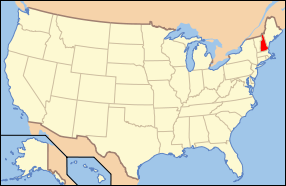
The theme of this month’s posting is verticality.

To start the theme, I chose a side view of Coe-Brown Northwood Academy in Northwood, New Hampshire. The academy is a public high school, originally founded as a private high school in 1867. That’s a rather common situation here in New Hampshire. Named for two benefactors, the school welcomes students from Northwood and surrounding towns. That’s also common here—economy of scale.
It sure is a vertical old wooden building, with high piles of snow lining the parking lot. The red car is included because it is red, and because it has a Coe-Brown magnetic sign attached to it. It updates the image to the present times.

The Maplewood Golf Course clubhouse, 1919, in Bethlehem, New Hampshire echoes the shape of the surrounding mountains.
The eastern half of the town is within the White Mountain National Forest. Bethlehem is one of the many towns in New Hampshire that were, or still are, summer resort towns. Families came by train to spend several weeks in July and August in the cool, clean, mountain air. They came from Boston, New York City, and beyond. Bethlehem had a wooden boardwalk, suitable for evening strolls. It was known to be virtually pollen free. Many businesses were formed here to serve the needs of hay fever sufferers and asthmatics.
But the improved road system, availability of private cars, and other social factors put an end to most of the large hotels’ summer business. Some still survive with creative guest amenities, and of course with the lovely mountain views. Skiing and other winter sports are very important to the economy of the mountain area.

Bretton Woods lies within the town of Carroll, New Hampshire. The large, rambling hotel is the Mount Washington Resort. It includes summer attractions like the golf course seen here, as well as 101 ski trails.
Many people associate the name Bretton Woods with the 1944 conference which established much of the International Monetary System that we know today.
Mount Washington is the center peak. At 6,288 feet, or 1,917 m, it is the highest peak in the Northeastern United States. The peak is located in Sargent’s Purchase, one of New Hampshire many unincorporated land areas. Foot trails and bridle trails abound. As well as a paved road, and a cog railroad too, built in 1869 and going all the way to the summit. Some years, a car race to the summit is part of the excitement. A Subaru holds the record.
The mountain, in an alpine zone climate, is known for ferocious and capricious weather patterns. One day out of three has hurricane force winds. The main structure atop the mountain is designed to withstand winds up to 300 mph. Most structures there are chained down.

The Balsams in Dixville Notch, NH sits tightly between water, rock, and sky. Dixville Notch is not a town but an ‘unincorporated location’. There are 25 such places in the state, but this one is easily the most accessible and the most well known. The others are generally uninhabited, mountainous, and accessible only on foot. I’ll get to them some day, perhaps.
Dixville Notch is among the small New Hampshire places that vie for announcing the ‘first in the nation’ voting results on election day, usually a few minutes after midnight. Last year Obama and Romney tied, 5 to 5.
Contrary to my usual procedure, there was no question whatever about what I intended to draw when I got here. Usually it’s a wonderful process of discovery, complete with quite a few u-turns, but this one was an obvious choice. The Balsams and the other surviving Grand Hotels are among our treasures here in New Hampshire. They date from a very different age, when well-to-do families would come by train for the summer to escape the industrial cities.

Plenty more turrets and peaks in Whitefield, NH. Concerts from the wooden, latticed bandstand are a summer highlight. As I drew this from the town green, a few people were keeping an eye on me. And wondering about my unusual interest in the old commercial block of shops and the landmark band stand.
Whitefield still has a grand old hotel from the heyday of the area, the Mountain View Grand Resort and Spa, recently renovated. And Weathervane is a repertory company theater in town.

Before posting, I do some research on line about each town. If Google maps are accurate, the town of Berlin (accent on the first syllable) is a perfect parallelogram. And my Wikipedia readings also state that Berlin is less than 100 km from Quebec. And that 65% of the residents are able to speak a language variant called Berlin French.
The mountainous area is heavily forested and, as a result, the European settlers developed logging, and wood and paper industries. The swift current of the Androscoggin River provided the power for the sawmills and helped move the logs. The people power came from immigrants from Russia, Norway, Italy, Sweden, Ireland, Germany, and French Canada. Each immigrant group had its own social services, including churches and meeting places. In the latest census, nearly 100% describe themselves as American.
In my drawing, three churches stand out because they are taller than the trees surrounding them. The hillside is completely covered in housing. You would see it better had I been there in winter.
On the right is almost exactly one half of the back side of the City Hall. The brick buildings line the main street. A metal industrial building and a waterway in the foreground are part of the paper making factories. Or were. The paper industry is gone now.

Jackson, NH is a lovely resort town in the White Mountains. It was once named Adams, in honor of President John Adams, then renamed Jackson to honor President Andrew Jackson. The town has decided to stick with this one, rather than honoring each president. (Joke.) Every town I read about in New Hampshire has had several names in its relatively short life. Some have had five or six.
Jackson Falls is a great place to draw, and I wasn’t the only artist there. In 1847, artists of the White Mountain School in nearby North Conway began to come here to take lessons and haul easels and paints around to sketch the scenic spots.
Over four hundred artists were known to have come here in the early 1800s, prompting tourists to arrive to see the beauty for themselves. In the latter half of the century, some artists had studios in the hotels. By the end of the century, many of the artists had moved west to paint the Rocky Mountains in the western part of the US.
Winslow Homer made a well known painting of the painters. Artists Sketching In the White Mountains now resides in the Portland (Maine) Museum of Art. You can see it on line (click).
I didn’t know this when I arrived with my paper and colors, and I was surprised to see artists all over the place. Every little bump on the rocks in my drawing is an artist. We are all keeping the tradition going.
It is not easy drawing a steep waterfall, standing at the top and looking down. All I could do was show the water currents splashing against the rocks and a little water in the air.
Wildcat Mountain may be the name of the peak you see here.

Randolph has a very small population, under 300, but a wonderful view of the Presidential Range of the White Mountains. It is named for the senator John Randolph of Virginia.
My composition includes the cross-continental US Route 2 highway and a sort of meandering minor parallel road. I imagined the bird’s eye view of the two roads, but drew the land forms accurately.

Benton, a small town with a population of less than 400, is almost entirely surrounded by the White Mountain National Forest. The Appalachian Trail crosses through the town. This hiking trail covers approximately 2200 miles (or 3500 km) in length, starting in the state of Georgia and ending in Maine.
Senator Thomas Hart Benton is the namesake of this small community. (His great nephew of the same name was a prominent painter.) The senator’s life story, as I read it online, is hair raising. And he is one of eight senators profiled in John F. Kennedy’s book Profiles In Courage.
This is Benton’s town hall and offices. Plain colored and simply shaped, the building was constructed during the austere days of WWII.
The very ornate wrought iron fence across the street and up a steep hill is from a very different era. Encircling a old grave yard, it made a good contrast.
Benton was once home to NH State Sanatorium. The clear mountain air was thought beneficial to people with tuberculosis.

Ellsworth, NH, population under 100, is not too easy to find, but the residents probably like it that way. A sign, not drawn, warned of a 15% grade hill. It sure was. Our car is parked on the sandy shoulder, not falling off the edge of the road into a ditch as it appears to be.
The combination town hall and school house, painted wood, was built in 1814. The bulletin board on the outside of the building gives a voter list for the town. 7 Democrats, 7 Republicans, and 57 undeclared voters. Undeclared voters are usually called independents, and boy are they ever.
As I drew, I sat on a bench on the front lawn of the St. John of the Mountains Interdenominational Church.

Warren, New Hampshire was named in 1770. In the town center are the customary town hall, library, church, school, and a playground off in the background.
But what every visitor remembers, or comes to see, is this Redstone ballistic missile mounted on a base right next to the above mentioned buildings. It is of course non-functioning.
The missile was given to the town in 1971 by Henry T. Asselin in honor of Senator Norris Cotton. It is a very, very odd thing to find in a little town, but I felt I had to draw it. Missiles like this and maybe this very one were positioned in NATO bases in Germany during the Cold War. I had to look up the dates of the Cold War: 1947 to 1991. It was all about the Western Allies and the USSR facing off in Eastern Europe after WWII. The fall of the Berlin Wall in 1989 was the beginning of the end of this period.
It’s common to encounter identically named towns throughout the New England states, usually tracing back to where the original settlers came from in England (or in some cases to an earlier settled part of New England). Warren is one of the few whose name appears in all six of the states. Thanks to artist friend Carol, from a very old New England family, for this tidbit. Can anybody name some other such towns?
This lovely urban block of stores sits in downtown Lancaster, NH. It is located on the Connecticut River, which is the state’s border with Vermont. Fertile, flat meadows along the river provide good agricultural soil.

The circa 1900 era urban architecture appeals to me for its exuberance and flourishes. Isn’t the curved roof line great? Benches, planters, and carved wooden bears rounded out the scene. The shops looked enticing from across the street. There were few people about. I think it was the July heat.
This blistering heat nearly wilted me while sketching this. The weather and temperature are two memories that always return to my mind when I look at one of my drawings. Other memories that flood back include the news and music on the radio and what I ate for lunch. A reuben sandwich I think ...
Horizontality is the theme above. And I include it as a break from the main theme of the posting.

Before doing research, I assumed Darby Field was a place name. It turns out that Darby Field (1610-1649) was a man well worth remembering. On the NH coast in Durham, he ran a ferry service across Great Bay to Newington. One day in 1642 when he was 32, who knows why, he decided to climb Mount Washington. He left journals describing the walk of many days to the mountain, the ascent, and precise details of the topography all the way to the top. He was the first European to climb it and it seems likely, the first person ever. The local Indian tribes thought it was an unwise idea to climb this mountain (sensible people), but a few did make the trek with him.
Many people of course have now climbed Mount Washington. Alas, many hikers have died trying, because of its horrible weather patterns, like whiteouts. This summer, I plan to go again. On the train, again.
Newport, NH has a week long winter carnival, the longest continuously operating one in the country they say. We went with the express purpose of attending an indoor event featuring a local humorist and storyteller, and with my idea to sketch figures out on the town green turned skating rink.

It had snowed heavily the day before, and the snow plow people piled the snow into one big mound. The children found it a lovely unexpected snow mountain to play on. The winter tableau in black and white emphasizes the figures and the motions.
I like to draw people in the wintertime. Everyone has big feet (boots), large hands (mittens), and over-sized heads (woolen hats).