Saturday, November 9, 2019

Berlin


In September we spent ten days in Berlin, the capital of Germany. Our last visit was six years ago with my sister and her husband, as part of a big self-guided tour through Germany, Poland, and the Czech Republic. This time — just us, one hotel, one city, no car, no tours. This was our third trip to Berlin since the Fall of the Berlin Wall 30 years ago today, and going back farther in time we had lived and worked there during the era of the Cold War and the Wall. So we have observed many contrasts, but also many wonderful continuing traditions. And we have joined in the celebrations of Freiheit and Einheit. Freedom and Unity! 

We did not adjust well to the six hour time difference from the East Coast US to Central Europe. So that meant late starts, afternoon naps, and lots of sit downs in cafés and park benches to refresh and rest. And that provides plenty of opportunities for sketching. I filled up two accordion sketchbooks as a visual diary. What follows is the best of them, plus a photo or two. 


We wanted to stay in a part of Berlin that we were already familiar with, so a search online found the Hotel Hommage à Magritte to be just the perfect match to all our criteria. It was located half a block from the Main Street of western Berlin, the Kurfürstendamm, it was in a neighborhood where we had once lived for a few months, and it was dedicated to the Belgian surrealist René Magritte, a master of trompe l’oeil paintings. Fool your eye. It did!

This proved to be a great choice. Small (18 rooms on one floor), reasonably priced, quiet neighborhood despite its proximity to the action, easy access to public transportation, friendly bilingual staff, and a nice breakfast buffet. Who could ask for anything more!

This photo of its exterior illustrates some of the Magritte style artwork that filled the place.

Hommage à Magritte, Grolman Straße 32, Berlin


My sketchbooks accompanied me throughout our visit. On this day we stopped for relaxation at a sidewalk café near the Reichstag building. And we laid out one of my accordion sketchbooks to help illustrate the many delightful aspects of our visit. You will also see our commonly referred to map of the Berlin transit system. It easily took us everywhere we wanted to go. 


The Reichstag is the equivalent of our Capitol building. Hitler manipulated its significance to gain support for his cause in the times preceding WW II. It was badly damaged during the war but later reconstructed, and it ultimately became the Capitol building for the reunited nation. The glass dome is a new addition. More modern buildings were quickly built nearby to house other aspects of the nation’s government.

The building is open for free public tours, but advance tickets are required and they go fast. We didn’t make it. Next time!


Kaiser Wilhelm Memorial Church, built in 1891 by Kaiser Wilhelm II in honor of his grandfather. This surviving spire, one of five, was partially destroyed by RAF bombs during WW II. It was reinforced and left to stand as a ruin, as a reminder of the horrors of war. A modern church stands next to it.


A church building has occupied this site in the former East since the Middle Ages. This particular one, called the Dom or Cathedral of Berlin, dates from the late 1800s. I drew the partial view as we sat at a small sidewalk café consuming our freshly made crêpes. While not a really common Berlin treat, this brought us both back to our times in France where I spent my junior year of college.


Alexanderplatz in the former East was a new place for us to explore. New to us, that is. Lots of the action of Berlin is moving in that direction, toward the early heart of the city. I stood in one place and sketched this image, and the next one too. Bruce wandered the market in the blue and white striped tents while I drew. He always seems to know how long it will take me. It was a wide open space, full of activity, including a yellow tram.


And here is my second half of Alexanderplatz. Sharing the space with modern office buildings are a Biergarten, a bungee jumping setup, and a two tier carousel.

Informally known to Berliners as “Alex”, the square was named for Tsar Alexander I of Russia on the occasion of his 1805 visit to Berlin. I guess the Germans wanted to make a good impression on him. It has become a transit hub, shopping area, and gathering place, and was the scene of the massive (a million people) protest five days before the Fall of the Wall.


On the major street called Unter den Linden, we came across these two living statues. Their clothes were all sprayed silver, and their faces were also covered in the same colored make up.  They were as still as statues until a person put a coin in the hat placed on the sidewalk. Then they moved for a minute or two in a kind of robotic way. Entertaining to watch. I sat on a bench behind them in the cool shade of a tree and sketched.

We did wonder what they first would do when they got home at night.


The famed Brandenburg Gate is the only surviving historical city gate. This was built in Neoclassical style in 1791. It was inspired by the gateway to the Acropolis in Athens. Perched on the top is the Quadriga, a chariot with four horses abreast and a center rider. It is said to be a symbol of the ancient Olympic Games. Napoleon once stole it, but the Germans got it back.

The gate became the symbol of a divided Berlin (1961-1989). In our time living for a few months in West Berlin, we could only see it at a distance, as it was entirely in the East with a wall separating it from the West. We only got a view of the tail ends of the horses. The night the Wall started to be breached, Berliners from the East climbed all over the barrier here.


The Ku’damm, or more formally the Kurfürstendamm, is a 2.2 mile long, tree-lined boulevard in the western part of the city. It was the Main Street of West Berlin during the Cold War. A little Googling gave me this historical tidbit: a Damm in German means a corduroy road. That is, a log road laid down over a swampy area. In this case constructed about 1542. Now it is one high end shop after another. And has been for decades.

I like to stand with my sketchbook in busy places and draw while all of life swirls around me. Here's the scene at a Ku'damm corner, a block or so from our hotel. I heard tiny bits of conversation as I sketched the sign post. A little child was showing his mom yoga poses as they waited for the light to change. The café was a challenge in complexity. How to indicate all the people sitting in the shade of the awning?


Our hotel in Berlin was a half block away from Savignyplatz, the confluence of seven streets and a rectangular garden. A charming, tucked away spot, with restaurants, bars, and bookstores. It was our local place to get public transportation too. Every day a nice retired lady helped us at the ticket machine. For a couple of coins in recompense to boost her retirement income. We looked forward to her help and usually needed it too, as the city is huge and has many integrated tram, bus, and subway lines, as well as trains to travel out of the city. I drew a fascinating brick church façade located just beyond the train tracks, the red and yellow train car, and book stores under the railroad bridge.


Another brick building called out to me on the other side of the tracks, just off of Savignyplatz. Drawing is a way of slowing down and looking very closely. When I did I noticed the symbols of a polo club carved into the façade.


Within a block of our hotel, I found this little children’s playground. It had some swings, and this wooden castle to climb on. I didn’t draw the part I liked best though — the mud. An old fashioned, metal, crank-handle pump could draw water into a series of troughs and down onto soft dirt. I saw the remnants of small footprints and gooey mud pies. How fun! I imagine the kids leaving their footwear at the door when they return to their homes.


Thirty years ago today, November 9, 1989, the Berlin Wall came down. Passage between the Soviet-held sector in the East and the Allied-occupied Western sectors was free and open in both directions. This and subsequent events led to the reunification of Germany on October 3, 1990, now a national holiday and a time for celebration throughout the country. We have been there on that date.

 Checkpoint Charlie is the best known of the official border crossing points. There is no Charlie; the name is just Army talk for the letter C, as there were two other checkpoints along the route for Allied travel from West Germany, across part of East Germany, and into Berlin — the lesser known Checkpoints Alpha and Bravo.

I drew the checkpoint from the distance of a café on the former East side. The sign is a photo of an American guard. On the back side is a photo of a Soviet guard. The tall green building houses a museum about the history of the Wall, and the many attempted and successful escapes from the East to the West. Lots of stories of tunnels, hollowed out suitcases, and even one homemade airplane.

Berlin bleibt doch Berlin. Berlin is always Berlin!

Freiheit!

Einheit!

If you wish to continue in the celebration and have an hour and a half available, click this link to view Leonard Bernstein’s amazing Berlin Freedom Concert, which he pulled together in just a month and a half after the Fall of the Wall.
Berlin Freedom Concert


If you’ve only got a minute and a half, here's a great clip from the occasion.
Berlin Freedom Concert, excerpt


To follow our activities during this trip, check out our daily blog:
berlintrip-2019.blogspot.com


Sunday, June 30, 2019

Big and Little


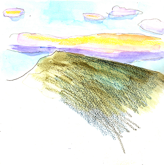
This is the view from our living room to the ridge, looking east. The colors are beautiful at the end of the day. 

We were leaving soon for some traveling from the eastern edge to the western edge of North America.

This blog posting is about two views of the world. Looking to the horizon, to see where you are in the big picture. And then, looking down and observing small things closely.


I draw this view of Boston every time I am in the WestJet terminal at Logan Airport. To be there, means we are on our way to visit with our grandchildren in western Canada. On the very far right, you can spot the tiny spire of the old Customs House, the only old building in the panorama and once the tallest building in town.


Our neighborhood in Edmonton, where our grandchildren and their parents live, is new. But it’s full of shops and happily, many ethnic restaurants. Our grandchildren love an outing to Wok Box. And grandson Shane, just turned 4, has mastered his alphabet and continues to be amazed by the backwards B in the logo at Best Bite.


Just a bit of looking closely, Shane’s soft ball.

 He himself is just starting to enjoy pushing a pencil around a sheet of paper. Now that he has quite mastered reading and numbers.


Another of my hat studies, the four year old’s cloth sun hat. I invented the beachy background.


And looking up and out and trying to take in the pleasing vista. When our daughter saw me pull out my sketchbook, she said in admiration of the view, “where do you start?” I answered “with the road”.

 Santa Catalina Island is twenty-six miles across the sea from the coast of California, as noted in the 1957 Gold Record by the Four Preps. This was our second trip there with family. And our first time getting this view of the town of Avalon, the only residential area on the rugged island. We got to this viewpoint in a rented golf cart, the approved means of transportation on the island.

The round building is a dance hall and movie theater constructed in 1929 to show ‘talkies’. It is very beautiful inside and out, and still used for these two purposes.


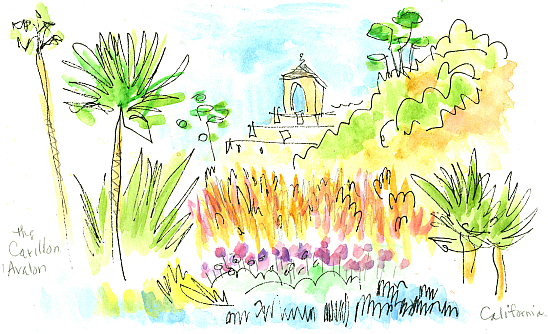
Facing opposite the entrance to the theater is this view of the Carillon in Avalon. It strikes the hours and plays the Westminster Chimes. We were in California during the spring big bloom. The seven year drought had eased and the flowers were showing their appreciation.

 People here on the island told me these wildflowers hadn’t bloomed in ten years.


Back to close observation. These are paper origami lilies skillfully made for us a few years ago by our now 14 year old granddaughter. We treasure them.


I’m pretty sure avocado toast was invented in California. Sketching food quickens up one’s drawing time for sure.

Speed drawn at Blue Bottle coffee shop, downtown Los Angeles.


In our condo in Edmonton, Canada, we have a very small red mosaic table. I have painted it and things on it many times.

It was not July when I painted this. I was flipping the calendar pages and planning ahead.


Having studied French for eight years, I enjoy seeing all the signs and labels in Canada in that language. ‘Framboises’ means raspberries, and ‘produit des E-U’ means product of the United States.

You can’t get too much smaller or close up than drawing these delicious red bumpy nuggets.


I bought some herb plants to draw, and consume. This is rosemary, a very fragrant resinous herb. The scent is a walk through a warm pine forest.


Some tomatoes need their portraits painted. It was very perfectly ripe and needed to be enjoyed on the day of purchase. So, another speedy sketch of delicious food.


The horizon here is Morgan Hill in New London, New Hampshire. The water is Pleasant Lake. The occasion was the first day out of school for the local kids,and their first swim to the raft. The branch Post Office is next to the beach. When I pick up our mail, I see beach scenes like this and sometimes take the time to get them down on paper.

I like the pointed rocks in the shallow water at this end of the lake. I have drawn them in all seasons.

Take small moments of time to slow down and look up, and look down.


Sunday, May 5, 2019

New Hampshire


Come see my upcoming exhibit.


Twiggs Gallery in nearby Boscawen, New Hampshire, is presenting an exhibit of art employed as illustration in books, and of books about art. I qualify in both domains and am happy to be included in the show. I will be offering the original drawings of three illustrations in my second book, Pep Talks for the Would-Be, Should-Be Artist, and also offering copies of all three of my books.

There will be an opening reception on Saturday, May 11, from 1 to 3, and the show will continue through July 11.

Now that I have included books in the art media that I deal with, I have come to notice some interesting observations from those in the publication business. They go something like, "Oh, you’re an author. You wrote the book. Who illustrated it for you?"

Nope, I do both, with of course the assistance of my family consortium of daughter Karin, the graphic designer, and husband Bruce, the indispensable computer guy in the middle.

The gallery is located at the western junction of US Routes 3 and 4 in Boscawen, a little bit north of Concord and close to Interstate 93. Hope you will be able to get there.


Wednesday, February 27, 2019

The Galapagos


The Galapagos Islands are a part of the South American country of Ecuador, and 600 miles west from the mainland. The sixteen islands and surrounding waters are under strict conservation regulations and require a special visa to visit. The week-long tour we took was on the 96-passenger ship Endeavor II, operated by the team of National Geographic and Lindblad Expeditions. Everybody we met on the boat was very committed to learning about the place. They weren’t just there for the ride. (But the ride, and the food, and the people were spectacular.)

The islands are directly south of Louisiana, USA, and in the Central Time Zone. Right on the Equator. As a side note, the currency since 2000 of Ecuador is the US Dollar, rate 1:1.


.
We visited the islands colored orange. Other boat tours visit the western islands too. The tour operator sometimes offers a deal on sticking around after one tour and signing up for the other one.

The islands are all of volcanic origin. The hotspot that feeds them remains stationary, deep in the earth, while the surface plate is slowly moving toward the east. So the far western islands are still volcanically active, while those to the east have cooled down, established their own ecology, and those even farther east have begun to erode and disappear.

Seven ocean currents converge in this area, one from Antarctica and others from warmer climes. Each occasionally brought with it a few members of a local species, somehow entangled in bits of branches or other floating vegetation. With luck they found mates and settled on whatever island they ended up at. They then began a long, long period of trying to exist there. Some of them made it and evolved to optimize a life in that ecosystem; others probably couldn't handle it and disappeared.

Examples of Galapagos evolution include the shortest penguins in the world, at about 1.5 feet tall. They don’t need to be any taller because they do most of their hunting underwater and don’t do much walking upright.

Another animal that evolved is a bird, the cormorant. It too moved to an existence where most of its food came from under water, so it no longer needed wings suitable for flying, and over time they shrunk to near uselessness.

Two different examples of how evolution didn't just work to enhance positive features, but it also favored reduction of no longer needed ones that simply absorbed excess energy that could better be put to use elsewhere.


The first evening on the ship, this sunset caused us all to ooh and aah, snap photos, and if you are me, sketch. I’m sure they planned it that way. The sunlight burst through the two gaps in the dramatic rock formation known in English as Kicker Rock. We were informed that the sun sets every night at 6:30, year round.


And the colors continued. The land on the horizon is San Cristobal Island.


Gardner Bay on Espanola Island. Yes, I sat in the sand and painted the sea lions as they napped, rolled over, swatted flies, and nursed from their mommies. We learned that they expend so much energy catching their breakfast that they snooze for most of the rest of the day. We have even seen them asleep on park benches in well populated areas. Everybody keeps their distance.

Our floating home is off to the left. Snorkelers and a Zodiak are in the turquoise water, just right of the center.


We took a hike on Espanola Island just before sunset. I sketched quickly when we stopped briefly. Gianna, our naturalist, explained everything in sight, as it was all new to us. A lighthouse, a cairn, a sea lion seeking shade, an iguana sunbathing to warm up, and a mocking bird in a prickly bush.


And more on the hike. A pelican silhouetted in the fading light. An iguana seeking shade to cool off, a colorful crab, and another bird—maybe a finch.

It was stunning to us, considering our background of having lived in Maryland, to see live red crabs. Live crabs in Maryland are blue, and they only turn red when steamed. These red crabs were amazingly mobile, able to jump quite a distance from rock to rock.


And our first sighting of Nazca boobies—the boobies with the grey-green feet, not the more famous blue-footed ones. And their new babies, who look just like balls of cotton fluff.

The law in The Galapagos is that you must maintain a six foot separation from any wild animals. It was a challenge when we came across a sea lion asleep in the middle of a narrow trail.


Every morning I pushed aside the cabin’s curtains to see what was out there. On this day, Floreana Island. It was not particularly comfortable painting while kneeling on the bed, but I persisted.


Another view of Floreana Island. The views change by the minute. As the clouds shift. As the anchored ship swings around in the water.

The black rubber rafts, called Zodiacs, ferried people to and from the white beach. Some landings were ‘dry’, at a dock, while others were ‘wet’. Wear appropriate footwear and wade ashore!


The top image is Endebi Island, which looked like an Egyptian Pyramid rising from the sea.
The lower image is Champion Island. We had options of snorkeling, a glass-bottomed boat tour, and Zodiac tours around the second island. My first sighting of blue footed boobies was here.


Another inspiring end of day view from the top deck. Post Office Bay is on the far right.


Next up, Santa Cruz Island. In the town of Puerta Ayora is the Charles Darwin Science Center for the study of the giant tortoises. And the successful attempts at re-population of some species. So a lot of baby tortoises were crawling about in their separate enclosures.

Even as I write this there have been reports of new discoveries of evolutional significance.


In one enclosure, these two types of tortoises were right next to each other. It was perfect viewing to compare the shell shapes. The guy on the left has a low, round shell, good for marching through heavy foliage and finding vegetation close to the ground. The fellow on the right evolved his (or her) shell shape on a different island where the vegetation is higher off the ground. So a longer neck is required, and an arched shell is also needed to give the neck ample room to move. You would not see these two in a natural state on the same island.


After the visit to the science center we got a ride into the town of Puerto Ayora. My feet stopped moving when I got to this cemetery right next to the narrow street.  Owls were painted on the high stucco wall. There’s a belief locally that owls help send our souls to heaven. A guide told us that a competition decides who gets the privilege of painting a new design.


And soon after that, I couldn’t get past this mosaic gate of a dragon, without opening my sketchbook. A lovely acacia tree blooms on the right.


Next up, the town fish market. All of the fish seemed to be pink, which was colorful next to the blue water of the harbor. Two pelicans are waiting for scraps. Sea lions pushed and shoved here too for fish heads but they didn’t make it into my drawing for some reason.


Then two, or was it three, buses took us to the Highlands, the hilly, tree-shaded top of Santa Cruz Island.

 We visited a family farm where we saw sugar cane squashed into juice, and the juice boiled.  Soft cheese cubes dipped into liquid brown sugar syrup were a delicious treat. Then came the fiery sugar cane liquor.

Before all that we saw the family coffee beans pounded to remove a husk, then roasted over a fire.


After cheese, sugar, and alcohol at the farm, it was time for lunch. We had a lovely al fresco meal at the Aquelarre Restaurant. The building, in the cool of the Highlands, was full of art and old bottles in the windows. The Chilean owners were most friendly.


A hibiscus bloom and some ginger blossoms from the gardens at Aquelarre.


I like signs. This one says it all, in two languages. It is where we changed into rubber boots in preparation for the muddiness ahead.


After donning our rubber boots, we took a walk through a lava tunnel. Not as scary as it sounds. Then we got to wander through a meadow, staying on the path, hoping to see the giant tortoises. Yup, there they were, lumbering about and munching on grass. I drew this one just as it began to rain. My husband held a plastic bag over my sketchbook so I could draw the large animal as fast as I could.


We stayed on an extra hour in the town of Puerta Ayora before returning to the ship. I took the time to sketch the end wall of the local kids’ skate park. I love all the large sea creatures painted by the young people who use the park. The black lizards were nearby on the sidewalk. I thought they would slither away, but they posed nicely for me.
I often copy children’s art.


Another view of a pretty place, Dragon Hill on the other side of Santa Cruz Island from the town. The trees along the top give it scale.


The top is Guy Fawkes Island. The bottom is just labeled ‘Zodiac wake’ in my sketchbook.

 
  In the lounge area of the ship were a coffee machine, hot water, and a selection of tea bags. It is entertaining to draw small things. They are part of the experience.

Also in the lounge were a bar and late afternoon yummy snacks. I finished my paintings in the lounge. And we saw several science related films in the area too. It was just a great hang out spot for the week.


One Zodiac, and four quickly drawn kayaks. The kayaks had just been put into the water in preparation for an afternoon activity.


Another island, another shape to capture in the sketchbook. Most islands in the Galapagos are uninhabited, by people. They abound in birds and reptiles.


On our last day we hiked on Genovesa Island. The ship anchored in a caldera (sunken volcano peak), and we climbed up a steep set of roughly cut rocks called Prince Philip’s Steps. The top of the island is flat and home to a million birds we were told. It certainly was a believable number. We kept to a narrow path, and we saw nesting bird families within three feet.

In my drawing, a red footed booby and a Nazca booby. The red footed ones, with the blue and pink heads, have evolved to have a thumb, sort of, and can roost on a low branch.


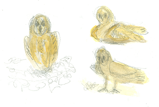
Celso, our naturalist for the hike, said we had to look very closely to see a short eared owl as they are exactly the color of the lava rocks. He was right. But we did spot two of them. This is three drawings of the same one.


My accordion sketchbook painted on the beach on Bartolomé Island.


Just for fun, and because a few people requested it, I gave an art talk on the last evening on the ship. I showed the drawings and paintings I had done that weekend in my sketchbook. Before I spoke, the ship doctor played his guitar and sang.
After my talk, a visiting photographer did splendid magic tricks.


Once back on the mainland, we took a tour of the city of Guayaquil. Highlights were a flower market seen from the bus, a city park full of tree climbing, striped iguanas, a view of a park along the waterfront, and a walking tour of an old part of the city that merges into a very new part. I drew this view of an old hillside neighborhood of the city, called Cerro del Carmen, from our hotel window.


And here is what is probably the most well known animal in the Galapagos, the blue-footed Booby.